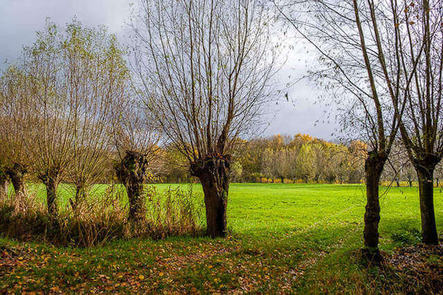
This hike goes through the Foundation of Boudelo nature reserve where moist areas, coppice forests, mature mixed deciduous forests, hay meadows, with field roads and pollard willows determine the view!
Distance: 12.5 km.
Time: 3h15.
Grade: Moderate.
Type: Circular.
Gps Track: Yes.
Route description: Yes.
Wheelchair: Not suitable.
Dog: Allowed.
Height gain: Flat.
Trail: Paved and unpaved.
Marking: Walking nodes.
Hiking shoes recommended.
The Linie.
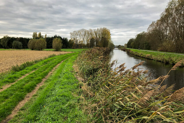
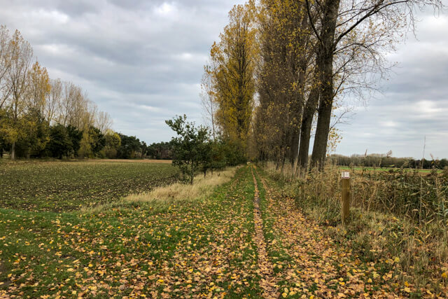
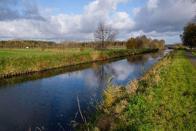
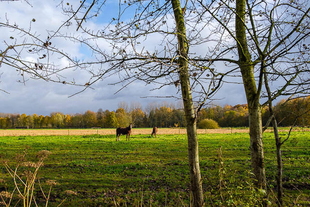
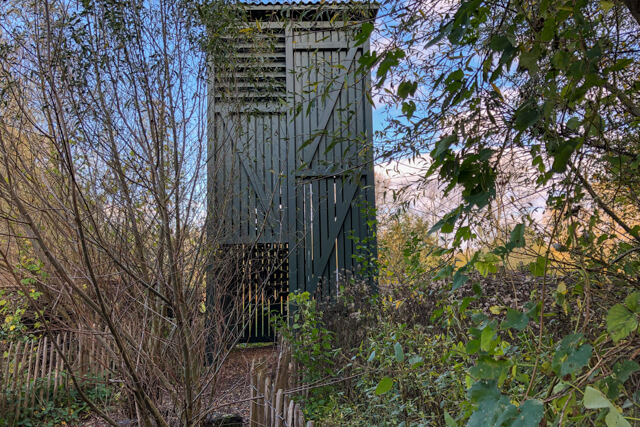
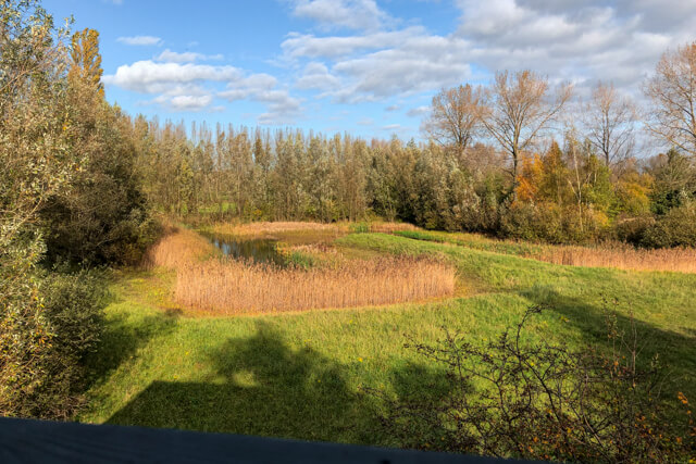
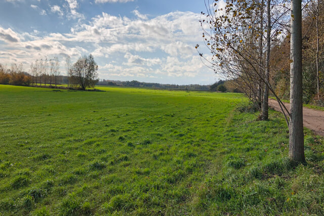
The walk goes in the direction of the Stekense Vaart. The canal was dug in 1315 and played an important role in the transport of the stones and bricks in the 16th and 17th centuries. They were made in the numerous brick factories in this region. You continue along the bank of the canal and along the Molen brook to a pumping station at the beautiful Frans Coppens bridge. Here you leave the canal and walk through the Aartdreef next to the Boudelo brook. Untill you reach the Liniedreef. The name refers to De Linie, the line of defense during the Eighty Years' War and the War of the Spanish Succession in northern Flanders. Then you walk along meadows where the old pollard willows stand out and on unpaved paths lined with poplars. The chance that you spot a deer here is very high. A narrow forest path takes you back to the Liniedreef. At the end of the lane is an eight meter high viewing tower. On the tower you have a good overview of a former U-shaped fishpond and the grasslands around it. This pond has been completely redesigned: the sloping banks ensure that young water birds and amphibians can easily enter and leave the water. Deer are mainly active here in the morning and at nightfall. Kingfishers come to hunt young fish, and the pine marten hides in the groves and orchard behind. The stately beeches that line the avenue are beautiful. You go a short distance via a cycle path in the direction of the Koebrug. Once you cross the bridge, you follow the banks of the Stekense Vaart again. Then you walk back in the direction of the starting point via unpaved country roads with beautiful views.

Download PDf for nodes to follow.
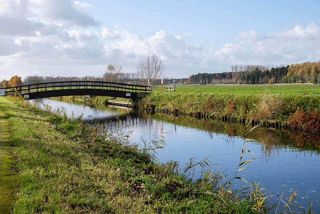
POI 1 - Frans Coppens bridge.
Very worthwhile, the view of the Stekense Vaart from this narrow wooden arch bridge that seems to have walked out of a painting by Monet. The pumping station serves to pump the excess water from the lower surrounding area to the canal.
Tourist Office Stekene.
www.stekene.be.
POI 2 - Foundation of Boudelo.
The Boudelo Foundation is largely located south of the Stekene Canal in Sinaai and is one of the most valuable nature and quiet areas of the Waasland. Moist rooms, coppice forests, mature mixed deciduous forests, hay meadows, a high-altitude orchard and beautiful pools determine the landscape. Thanks to a focused management, nature gets all the opportunities here again.
Vzw Durme.
www.vzwdurme.be.