
Walking route
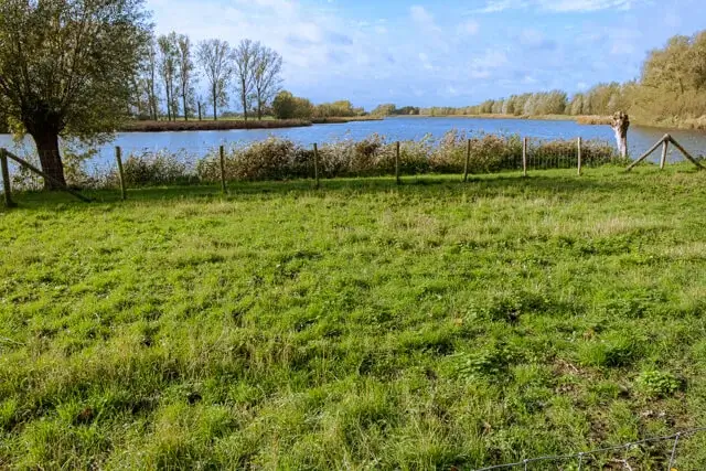
Kieldrecht creek.


A walk for lovers of beautiful polder landscapes and old dikes. The Grote Geule creek and the Drijdijck nature reserve are ideal places for water and marsh birds.
Distance: 12 km.
Time: 3h00.
Grade: Moderate.
Type: Circular.
Gps Track: Yes.
Route description: Yes.
Wheelchair: Not suitable.
Dog: Allowed on leach.
Height gain: Flat.
Trail: Paved and unpaved.
Marking: Walking nodes.
Hiking shoes recommended.
Grote Geule and Drijdijck.
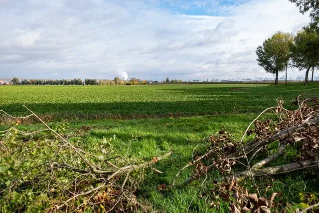
You depart from the Sint-Michiel church in Kieldrecht and go along the Tragel to the Grote Geule. A small road along the nature reserve gives you a beautiful view of the creek and the surrounding polders. The nature reserve itself is not accessible. The Grote Geule is an old flood channel that was created during the Eighty Years' War. The current landscape took shape during the subsequent reclamation (1653). Rows of pollard willows, reeds and an open lake form a beautiful landscape. You cross the N491 and now go along the Vingerling path over the Arenbergdijk. This dike, which lies between the Oud Arenbergpolder and the lower Koningskieldrechtpolder, used to be called the Kleine and Grote Vingerlingwegel. You arrive at the Drijdijck nature reserve, which lies on the western edge of the port area. For water and marsh birds, this is a dream place to catch a breath during their long trek or to spend the winter. The nature reserve used to be arable land and pasture land and was part of the Verrebroekse Blikken. By excavating part of the site and raising the groundwater level, a valuable pool grass area was created. In winter, Drijdijck is more than half under water, which of course makes it attractive as a well-deserved stopover for migrating water and marsh birds such as the shoveler, gadwall and wigeon. Add to that the grazing wild horses and contrast with the rising industry at the horizon and you get an absolute postcard picture. Furthermore, you cross the N491 again and you now follow a long stretch through the polder with an old dike on your side lined with the typical poplars. You leave the dike and pass a small chapel of Onze-Lieve-Vrouw Van De Polder. On the Sint-Kornelisstraat you get a nice view of the Grote Geul. You go on paved roads in the direction of the Koningsdijk. The Koningsdijk is a dead straight connecting road between De Klinge and Kieldrecht. On this dike, lined with poplars, right on the Belgium-Netherlands border, you have to turn right towards Kieldrecht. But first walk a short distance to the left, then you will notice a rectangular area on your right with a large pond, a flagpole and a farm. Here stood Fort Fuentes / Spinola, a Spanish fort with a view of the polders between De Klinge and Hulst. It was founded shortly after 1591 to protect the Land van Waas against northern attacks. You can no longer see anything of the fort itself, but an information panel on the cycle path tells you more about it. You are now crossing the Koningsdijk in the direction of Nieuw Namen. At the end of the dike is an information panel about the Spanish Line. From the moment you reach the Dutch village, the walk actually has nothing to offer anymore.
Download PDF for walking nodes to follow and map.


Walks East Flanders.


