Walking route
Through the Aiguebrun valley.


Through the Aiguebrun valley.
Anyone who truly wants to discover the Luberon must explore the Aiguebrun Valley. This hike is a true classic in the Luberon Regional Nature Park. You first descend into the verdant Aiguebrun Valley, climb to the remote hamlet of Sivergues, and return via the expansive Claparèdes plateau.
Distance: 11 km.
Time: 4h00.
Grade: Moderate.
Type: Circular.
Gps Track: Yes.
Route description: Yes.
Wheelchair: Not suitable.
Dog: Allowed on leach.
Height gain: 300 meters.
Trail: Paved and unpaved.
Marking: GR - GRP and PR.
Hiking shoes recommended.
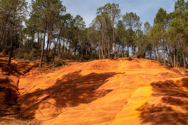
The Claparèdes plateau.
Buoux has a rich history, marked by the construction of the old village in the 17th century, the small Provençal church, and the surrounding country houses. The village is best known for Fort de Buoux, a medieval fortress perched on a rocky outcrop offering spectacular views of the Luberon. As you descend from the village of Buoux, you enter the lush Aiguebrun valley. The river creates a unique microclimate here. Gaze up at the world-famous limestone cliffs: the holes and cavities in the rocks (called "Baumes") once provided shelter to the region's first inhabitants and now attract climbers from around the world. After a steep climb, you reach Sivergues. This small hamlet, also known as "the end of the world," is built against the cliffs. The village exudes an atmosphere of yesteryear with its stone houses and narrow alleyways. It was once a safe haven for the Waldensians. Above Sivergues, the landscape opens up on the Claparèdes Plateau. This is the heart of Provence, pictured on postcards. Along the way, you'll pass several authentic stone huts (bories), built without cement. The plateau is dotted with lavender fields and the characteristic drystone walls (claparèdes) that give the plateau its name. In clear weather, the plateau offers a panoramic view of Mont Ventoux to the north.
Download PDF for route description and map.
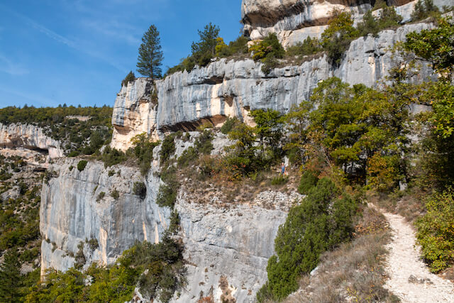
POI 2 - Aiguebrun valley.
The Aiguebrun Valley is characterized by high cliffs with limestone slopes and a jumble of boulders. The valley was formed approximately 6 million years ago after the drying up of the Mediterranean Sea! The water level dropped by about 1,000 meters, and the surrounding rivers carved out immense gorges that were later filled with sediment. Erosion during the ice ages made the cliffs even steeper.
No additional information.
POI 3 - Aiguebrun.
In the Mediterranean region, there are few more or less permanent waterways bordered by lush forests. The Aiguebrun is a case in point, and its valley is one of the most ecologically important sites within the park. Among the fish species found there are brown trout and southern barbel, as well as the elusive and rare white-clawed crayfish. The presence of these three species underscores the good health of this ecosystem.
No additional information.
POI 4 - Sivergues.
Over the centuries, the village has changed little; only a few houses have been built around the old fortified house, now known as the Archdeacon's Fort. The observant visitor will notice the oculus (round window) on the modest façade of the Church of St. Peter and St. Mary (late 16th century), the cobbled streets, the vaulted staircase, the stone gate… Every building in Sivergues blends seamlessly into the landscape and offers magnificent views.
No additional information.
POI 5 - Plateau of Claparèdes.
The name Claparèdes comes from "clapas," which means "pile of stones" in Provençal. Numerous stone huts are scattered across this plateau, which stretches for about ten kilometers from Castellet to Lacoste. The Claparèdes plateau was once used for cereal crops, but today it is primarily used for lavender.
No additional information.


Walks Vaucluse.