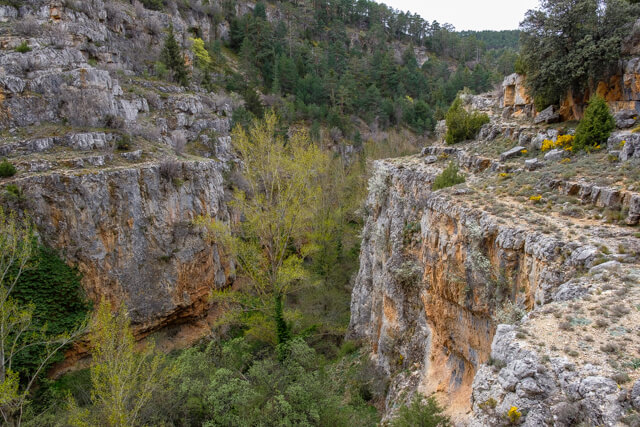
The walk starts in the small village of Tramacastilla and first goes on a wide dirt road along the wide valley of the Guadalaviar past fields and orchards. Afterwards it continues through a pine forest high above the Hondo valley, where you sometimes already have a view of the deep narrow gorge. You then descend to the ruins of an old water mill. Here you cross the river and walk high above the gorge with beautiful views of the river and the surrounding area. The wild goats and griffon vultures will certainly be there.
Distance: 10 km.
Time: 3h00.
Grade: Moderate.
Type: Circular.
Gps Track: Yes.
Route description: Yes.
Wheelchair: Not suitable.
Dog: Allowed.
Height gain: 202 meters.
Trail: 98% unpaved.
Marking: See PDF route description.
Hiking shoes recommended.
Advertisement.
Barranco Hondo.
The walk starts at the Plaza Mayor in the small village of Tramacastilla. You leave the village via an asphalt road until you reach the bridge of the river Guadalaviar. You cross the river and you now follow a wide unpaved road, you soon come across an information sign. Follow the marking of the PR-TE 3. You walk along the wide valley and you have a view of the various fields and orchards. At the end the road bends to the right. Here you continue to follow the green marking. You now go through a pine forest and climb high above the Hondo valley. After a sharp hairpin bend the road goes down until you reach the ruins of the watermill. This is a nice place to take a break. Follow the river a bit further until you reach a dam. Here you can cross the river via the dam. You now go back along the other bank to the ruins of the water mill. A double green line shows you the route, but that is not always clear, so you sometimes have to look carefully where the path runs. You now climb high above the gorge and follow the stony path, on some parts you have to use your hands and feet for a moment without it becoming really dangerous. Once you start descending, you follow a water canal for a while. At a certain moment it is just as good to watch out and you have to leave the channel to bend to the right. You cross a field and you come to a bridge over the river, you cross it and follow the dirt road to the village.

Download PDF for route description.
Not suitable for people with fear of heights.
POI 1 - Ruins of the old water mill.
The water mill was first used to grind barley and later served as a small power plant, currently not much of it remains.
No additional information.