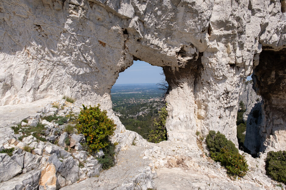
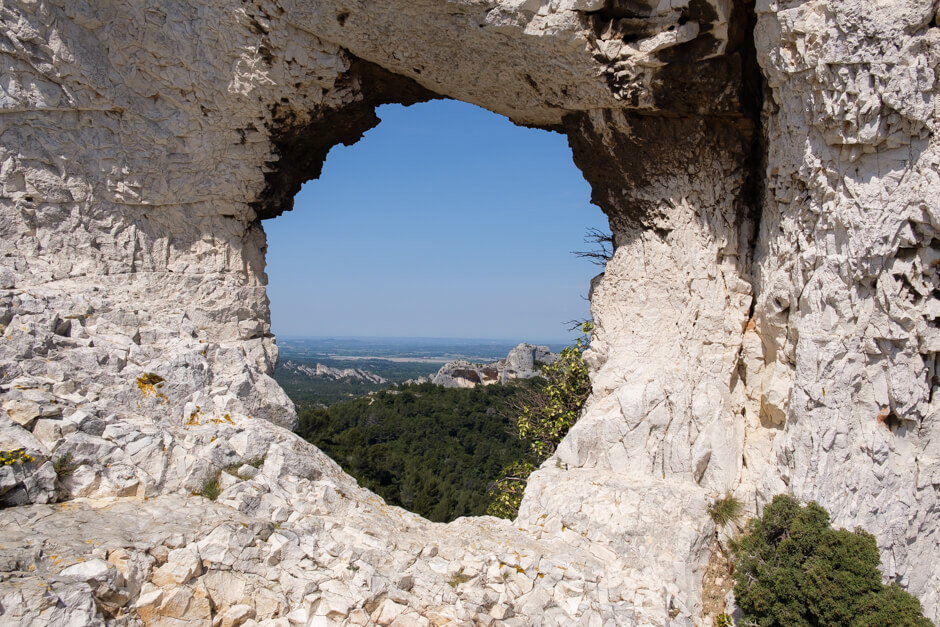
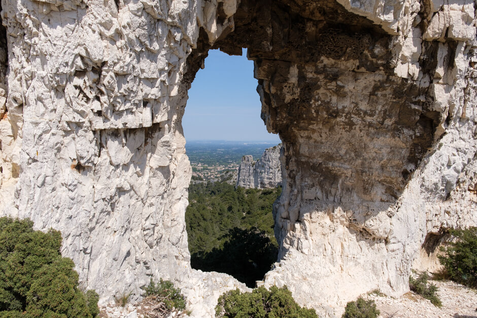
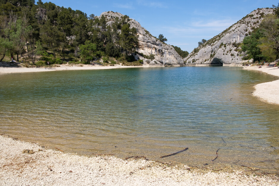
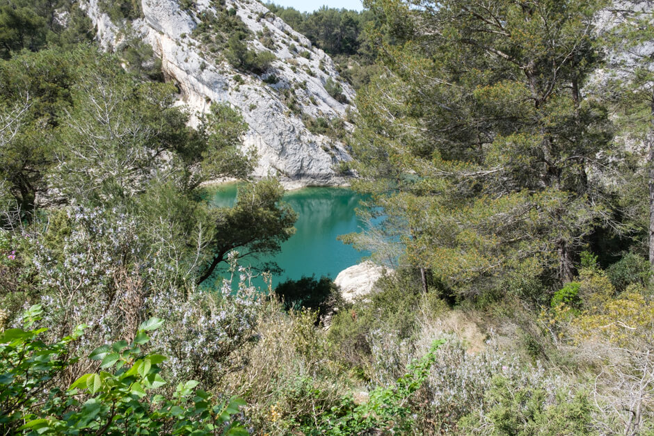
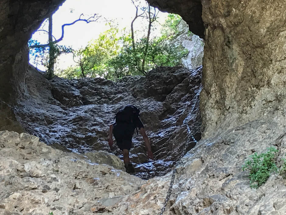
This walk in the Les Alpilles nature park is one for the adventurers among us. Via the plateau de la Caume it goes in the direction of the famous Rocher des Deux Trous. The next goal is the Mont Gaussier that you reach via metal ladders and some secured passages. The view is fantastic. After a steep descent, you continue to the Lac de Peirou, where it is best to take a break before you start the climb to the "chimney". Along a few iron steps and secured passages you climb through a large hole in the rock to the other side of the mountain.
Distance: 8 km.
Time: 3h00.
Grade: Heavy.
Type: Circular.
Gps Track: Yes.
Route description: Yes.
Wheelchair: Not suitable.
Dog: Allowed.
Height gain: 422 meters.
Trail: 95% unpaved.
Marking: Partial - GR6 - Blue.
Hiking shoes recommended.
Advertisement.
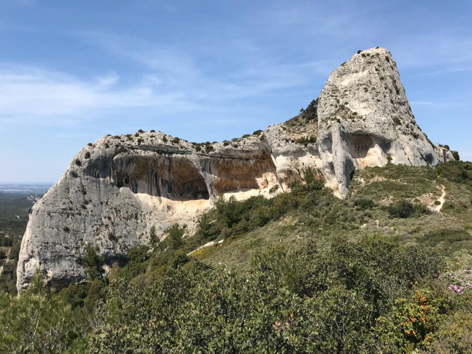
Rocher des Deux Trous.
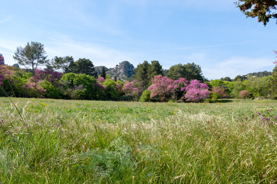
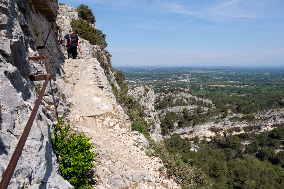
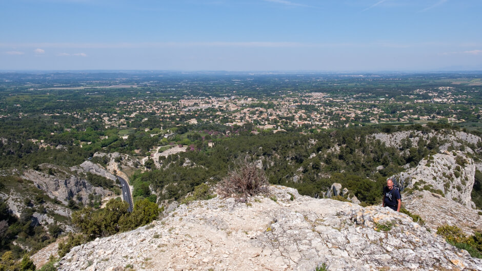
The walk starts at the Saint-Paul de Mausole monastery via a nice wide road in the direction of the protected area of La Caume. Via the GR6 you ascend through a beautiful valley to the plateau de la Caume. On the plateau you will already have some beautiful views. From the plateau it continues in the direction of the famous Rocher des Deux Trous. The two "windows" in the rock provide a spectacular picture. You start a steep descent via a viewing point and then start the climb to Mont Gaussier. You get a secured passage with cables to handle at a narrow elevation and a metal ladder before you reach the top. The panorama is fantastic, with clear weather you can even see the Mont Ventoux. Now a very steep descent leads you to the D5. You cross the D5 and you soon arrive at the picturesque Lac de Peirou. Here it is great to pause and enjoy the view of the lake. Via the GR6 you now start an adventurous climb to the "chimney". Via a secured passage with cables you reach the beginning of the 'chimney', high above you see the sky through a large hole. You climb up a few metal steps and a secured passage. Once you have overcome this obstacle, the descent to the D5 begins, which you follow to the starting point.

Download PDF for route description.
This hike is not recommended for people with fear of heights.
During the period from June to September there is a regulation concerning fire hazard. Inquire during this period on the telephone number: +33 (0) 8 11 20 13 13 or at the Office du Tourisme.
POI 1 - Mont Gaussier.
The Gaussier mountain is a 306 meter summit in the Alpilles, south of Saint-Rémy-de-Provence. Nowadays the mountain is best known by the many hikers who follow the GR6 here. The mountain was already used as a habitat in prehistoric times. In the Middle Ages there was even a castle that has completely disappeared today. The two holes in the Rocher des Deux Troux are the result of wind erosion in the limestone of the rock.
Parc naturel régional des Alpilles.
www.parc-alpilles.fr