Select your language

-
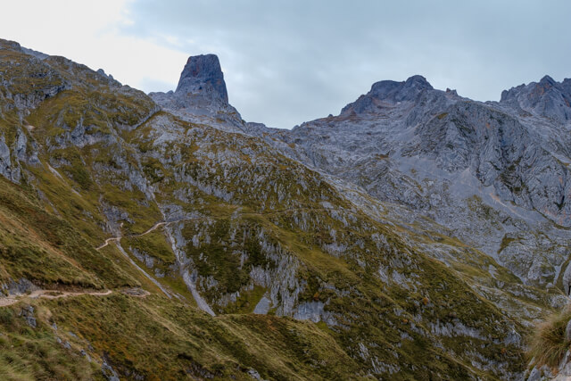
Cabaña Veronica
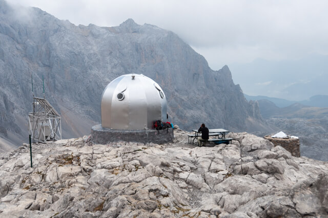
This hike goes from the funicular of Fuente Dé to the beautifully situated cabaña Veronica at the foot of the Torre de Los Horcados Rojos. The road to the iron igloo gives you a nice impression of the rough and desolate landscape of the Picos de Europa.
-
Hayedo de las Ilces
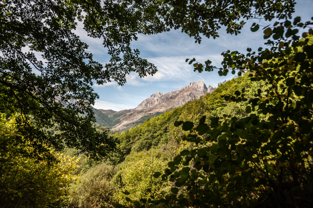
This walk goes from the beautiful village of Espinama through beautiful beech forests (Hayedo) along the Pierga path in the valley of the Deva to the hamlet of Las Ilces. Brown bears are said to live in these pristine forests at the foot of the Coriscao.
-
Hermitage Nuestra Señora de la Luz
To reach the hermitage of Our Lady of the Light, you must ascend more than 600 meters in the first three kilometers. The chapel is located just below the peak of the Peña Sagra (2048 meters), the sacred mountain.
-
Pico Coriscao
The Pico Coriscao is not an easy mountain if you start from Cosgaya but it is if you leave from the Mirador de Llesba. The Coriscao belongs in the top 3 of the best miradores of the Picos de Europa, from the top at an altitude of 2234 meters you look straight at the Peña Vieja (2613m) and the Morra de Lechugales (2444m). The Coriscao is made, as it were, as a viewpoint because the view is more than worthwhile in the other directions. In the south is the Pena Prieta (2539m) and in the west you can see the Peña Ubina (2417m). Below you can see the large oak forest of the Liébana Valley.
-
Pico Jano
At the top of the Pico Jano you have a unique view of the Liébana valley with in the background the eastern part of the Picos de Europa, the Andara massif. The villages that you see deep in the valley are Mogrovejo and Tannario.
-
Refugio Vega de Ario
This walk, in the western part of the Picos de Europa, takes you along Lake Ecrina on a stony path to the refugio Vega de Ario. Along the way you have beautiful views and you pass typical shepherd's houses that are still in use. On the Collado El Jito you have a beautiful view of the massif of Urielles and there is an orientation table indicating all the surrounding peaks.
-
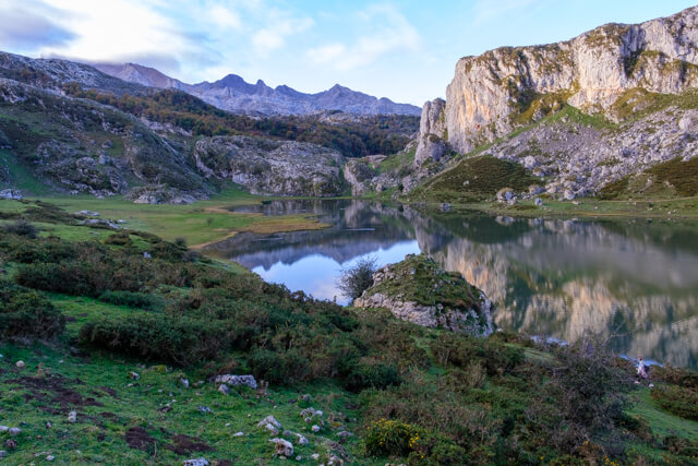
Refugio Vegarredonda
This walk goes along Lake Enol over the plateau of the same name. Once you've crossed the Rio Pomperi, the real work begins. You go along a stony path to a boulder called La Piedrone, around which are typical shepherds' houses. You now climb high above the valley, with beautiful views along the way, in the direction of the refuge Vegarredonda at an altitude of 1460 meters. The refuge is on the route to the Mirador De Ordiales. On the way back you can even see the sea in clear weather.
-
The Cares gorge
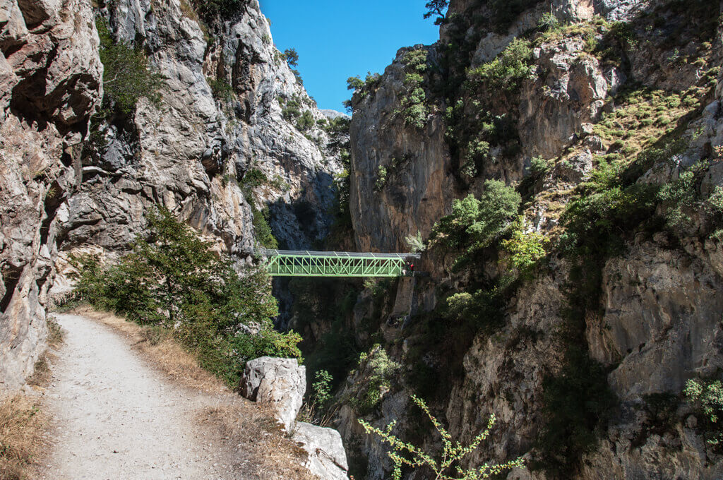
The walk through the Garganta del Cares, literally the throat of the Cares, is probably the most traveled trail in the region. Rightly so, because this is a unique gorge where in some places the Cares River flows 800 meters deeper. The Cares path was constructed in 1946 to maintain the Hydro Canal, which was constructed between 1916 and 1921.
-
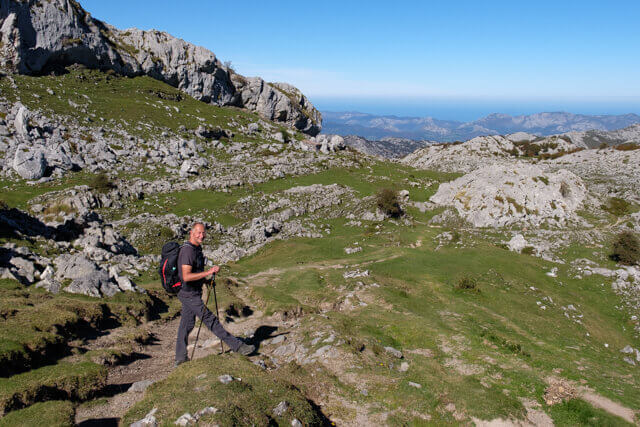
Torcasierra
This mountain hike is ideal for people who want to get acquainted with the high mountains. From the invernales de Cabao, the route follows a wide dirt road in the direction of Arroyo De La Canero. Further on you walk over mountain trails to the Collado De Pandébano at an altitude of 1281 meters. After the Refugio De La Terenosa you start the climb to Torcasierra. At Torcasierra you have a unique view of the Picu Urriellu (2518 meters).
-
Vega de Liordes
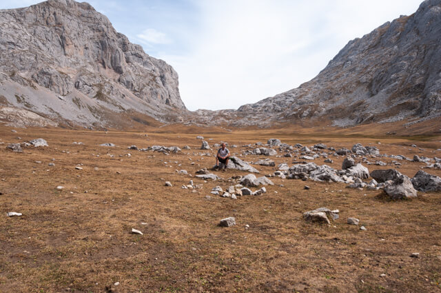
This beautiful mountain hike takes you via goat paths and the debris couloir Canal de Pedabejo to the unique plateau of Vega de Liordes. This mountain meadow of one kilometer in diameter is located at an altitude of 2000 meters and has an exuberant mountain flora in a beautiful setting.