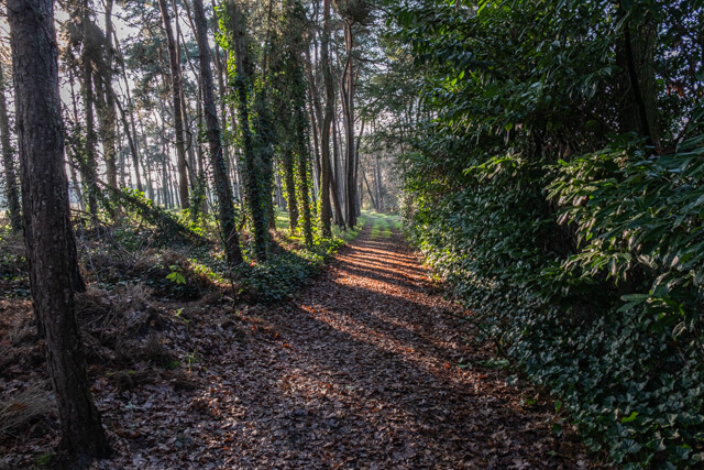
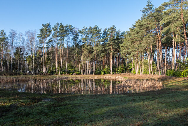
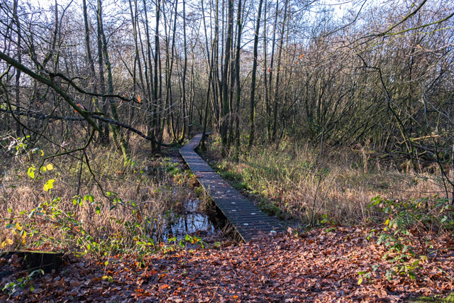
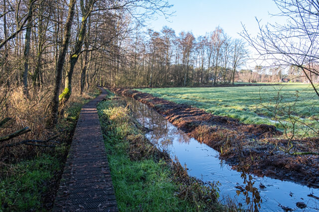
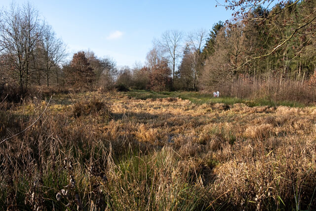
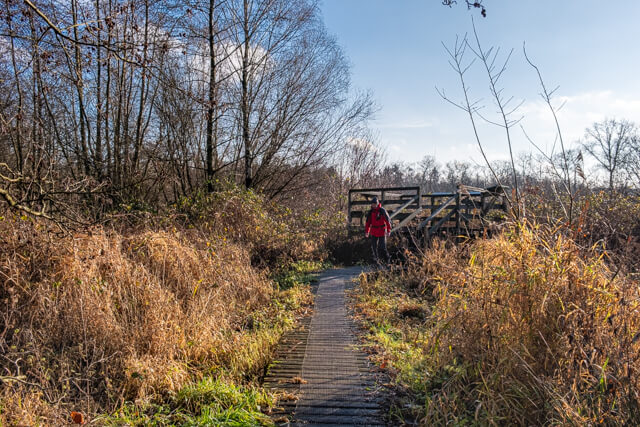
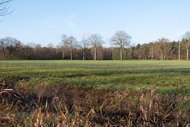
This walk goes from the Boseindse Bergen forest to the valley of the Witte Nete. Here you walk on a plank path along the Zwarte Nete through trouser forests and soaked swamps with strange names such as the Haring, the Weense Putten and the Koeibemdekens. Then it goes in the direction of the Retiese water mill on the Witte Nete. From the mill you walk to the Beverdonkse Heide a patchwork of forests and open plains, meadows and fields.
Distance: 10 km.
Time: 2h30.
Grade: Easy.
Type: Circular.
Gps Track: Yes.
Route description: Yes.
Wheelchair: Not suitable.
Dog: Allowed.
Height gain: Flat.
Trail: 80% unpaved.
Marking: Walking nodes.
Hiking shoes recommended.
Advertisement.
Witte and Zwarte Nete.
The route goes from the starting point along a paved road to the Boseindse Bergen forest. You go through this coniferous forest along small forest paths in the direction of the Valley of the Witte Nete. Here you walk on a plank path through trouser forests and marshes to a viewing platform where you get a view of the Witte Nete. Along the way there are several information boards with the title "Back to the future". The signs show photos of the area between 1940 and 1950 that were made by Henri Van den Wildenbergh. At junction 43 you will come to a place where there used to be an water mill, where you can have a nice picnic. Along a paved road you walk to the Retiese water mill. From the mill, the walk continues on unpaved roads and paths through the Beverdonk Heath. Just before junction 93 you can bend off the path and go to a memorial plaque for a crashed Halifax during the Second World War, about 1 km extra. The last part goes mainly through a pine forest back to the starting point.

Download PDF for nodes to follow.
POI 1 - Witte Nete Valley.
Because the Witte and Zwarte Nete overflow during wet periods, a thin layer of loamy material is deposited. This process has been going on for thousands of years, slowly but surely creating a sand loam bottom, surrounded by a sandy landscape. Close to the historic watermill you can discover the river landscape, with mysterious trouser forests, flowery meadows and soaked swamps in places that listen to strange names such as den Haring, Weense Putten and the Koeibemdekens. If you look around, you can still see the network of ditches and canals, which used to be used to lightly drain the higher ground and to irrigate the lower parts with seepage water. In this way, the meadows could be mowed up to three times a year. All the way to the east of the Weense Putten are the remains of a peculiar geological phenomenon: a parabolic dune. That is a horseshoe-shaped dry sand strip with a flooded breakdown or low between the legs. For centuries, the dune was the favorite sand quarry for the hamlets in the area. As a result, only a ledge remains. The rest is processed in houses, bridges and roads.
Natuurpunt.
www.natuurpunt.be
POI 2 - Oil watermill.
A place where there used to be an oil watermill is now a nice place to have a picnic.
No extra information.
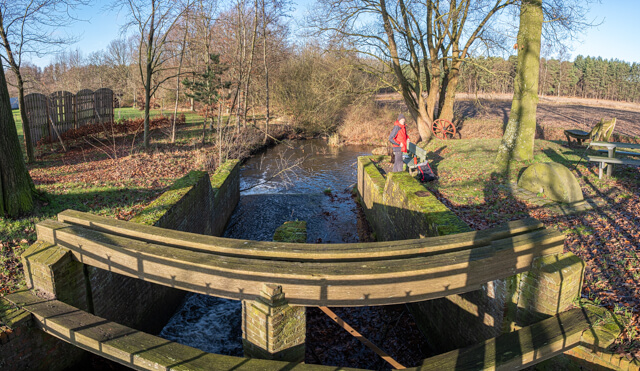
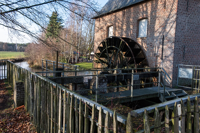
POI 3 - Water mill Retie.
There is a picturesque, grain water mill on the Witte Nete. Although the oldest mention dates back to 1633, this mill site probably existed in the 14th century. The current brick mill house dates from 1765 and replaces a wooden construction from 1658. Legally it was a so-called ban mill. Such mills were under the supervision of the village lord; every citizen was obliged to grind his grain there and to hand over part of the flour as a tax in kind to the sovereign lord. In the Middle Ages mills therefore radiated a certain power and influence. The water mill is of the lower type. This type was most dependent on the slow flowing watercourses in the Kempen. In order to increase the buoyancy and speed of the water, a weir and lock work was built. An artificial acceleration was created at the lower quarter of the wheel. Both the indoor and outdoor installation of this water mill are completely intact.
Gemeente Retie.
www.retie.be.
POI 4 - Halifax memorial plaque.
Before junction 93 there is a signpost to the Halifax monument. The monument is located 500 meters from the route, so 1 kilometer extra back and forth. On Saturday, October 23, 1999, a memorial plaque was unveiled at the place where Halifax II JN920 LK-L JN 920 of 51 Squadron RAF crashed 56 years ago, killing the seven crew members.
No extra information.