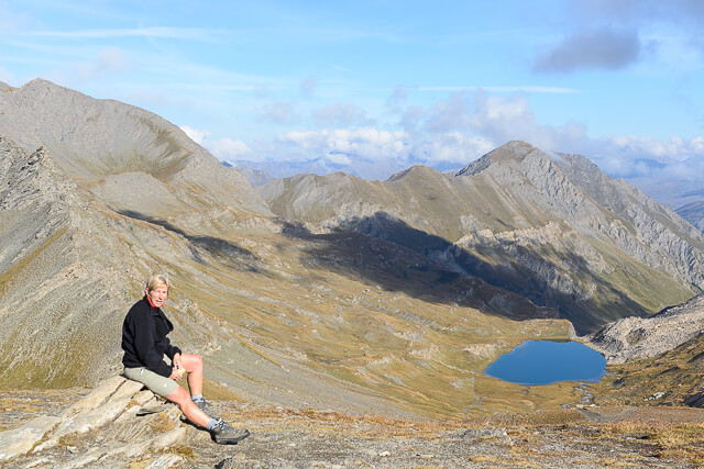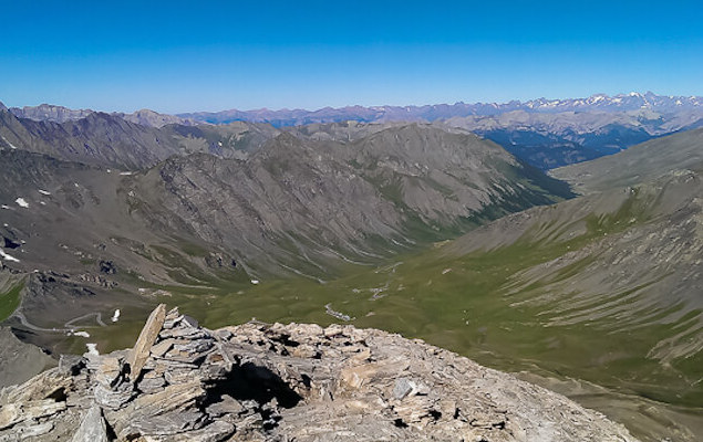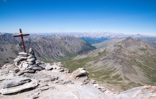
This trail is the classic in the Queyras and you will probably not be alone during the season. When you reach the cross at the top of Pain de Sucre, at an altitude of 3208 meters, you will be rewarded for the effort because the panorama is truly breathtaking. You have a view of the Monte Viso, the Alpes-Maritimes, the mountains of L'Oisans and La Vanoise and in clear weather even the Mont Blanc.
Distance: 6 km.
Time: 3h00.
Grade: Heavy.
Type: Back and forth.
Gps Track: Yes.
Route description: Yes.
Wheelchair: Not suitable.
Dog: Not recommended.
Height gain: 600 meters.
Trail: 100% unpaved.
Marking: Partly Red-White GR58 and cairns.
Hiking shoes recommended.
Advertisement.
Three-thousander on the French-Italian border.
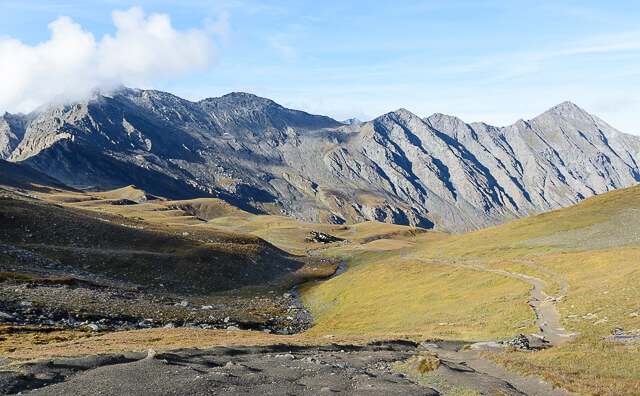
The ascent of the Pain de Sucre consists of two parts. The first part you follow the GR58 along the course of the Eychassier to the Col Vieux at an altitude of 2806 meters. On the Col, take the path to the right that is clearly recognizable and then the path that leads to a plateau. Continue east at the foot of the Pain de Sucre, the path is marked by cairns, on the right and goes around the foot of the Pain de Sucre. During the climb, make sure you stay on the main path (the easiest to the east - right), which gradually rises. The last part of the walk must be carefully watched to choose the right path among the various options, the path becomes steep over the last 100 meters where you sometimes have to use hands and feet.

Download PDF for route description.
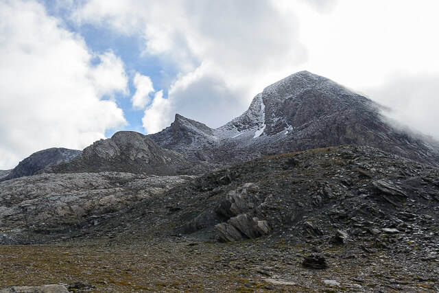
Not for people with fear of heights, the last hundred meters require a steady step!
POI 1 - Pain de Sucre.
On the ridge of the top you can enjoy various stone shelters to protect you from the wind so that you can fully enjoy the panorama and the surrounding mountains. The ridge of the Taillante in the north with the Lacs Egorgeou and Foréan below. The Italian Alps with, hidden behind the Pic d'Asti (3320m), the Monte Viso (3841m), the Po and Varaita valley. In the west you see the Grand Pic de Rochebrune and the rest of the Franco-Swiss Alps including the Mont-Blanc. The space at the top is limited but you will have trouble leaving again. The Pain de Sucre was previously called "Aiguillette".
Parc naturel régional du Queyras.
www.pnr-queyras.fr