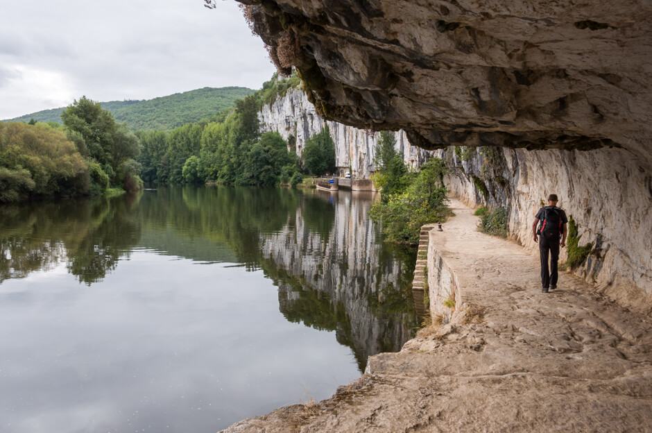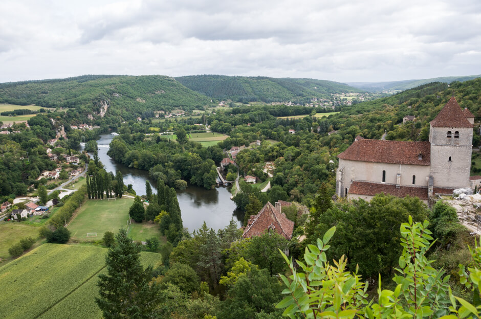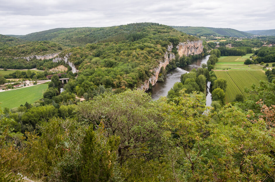
This walk goes along the banks of the Lot over the Chemin de Halage, a path carved into the rock that was built in 1845 to pull the flat-bottomed boats with goods upstream, towards the Garonne river and further up to Bordeaux. This village towers 80 meters above the river and has the label "Les Plus Beaux Villages de France"!
Distance: 8 km.
Time: 2h30.
Grade: Easy.
Type: Circular.
Gps Track: Yes.
Route description: Yes.
Wheelchair: Not suitable.
Dog: Allowed.
Height gain: 249 meters.
Trail: Paved and unpaved.
Marking: Red-White (GR) and Yellow (PR).
Hiking shoes recommended.
Advertisement.
Saint-Cirq-Lapopie.
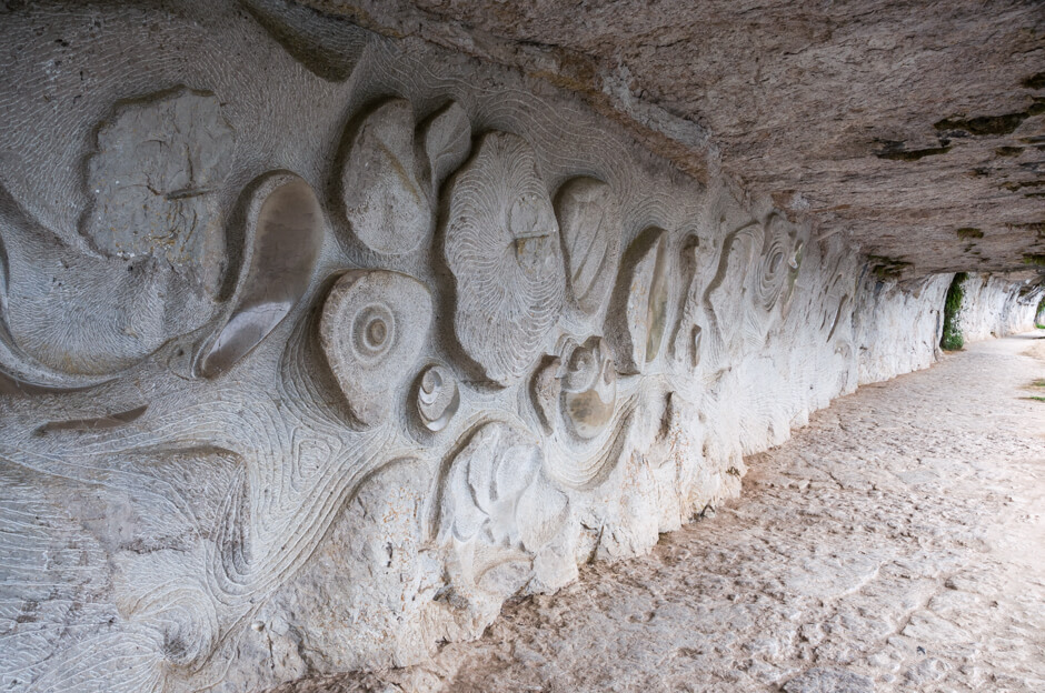
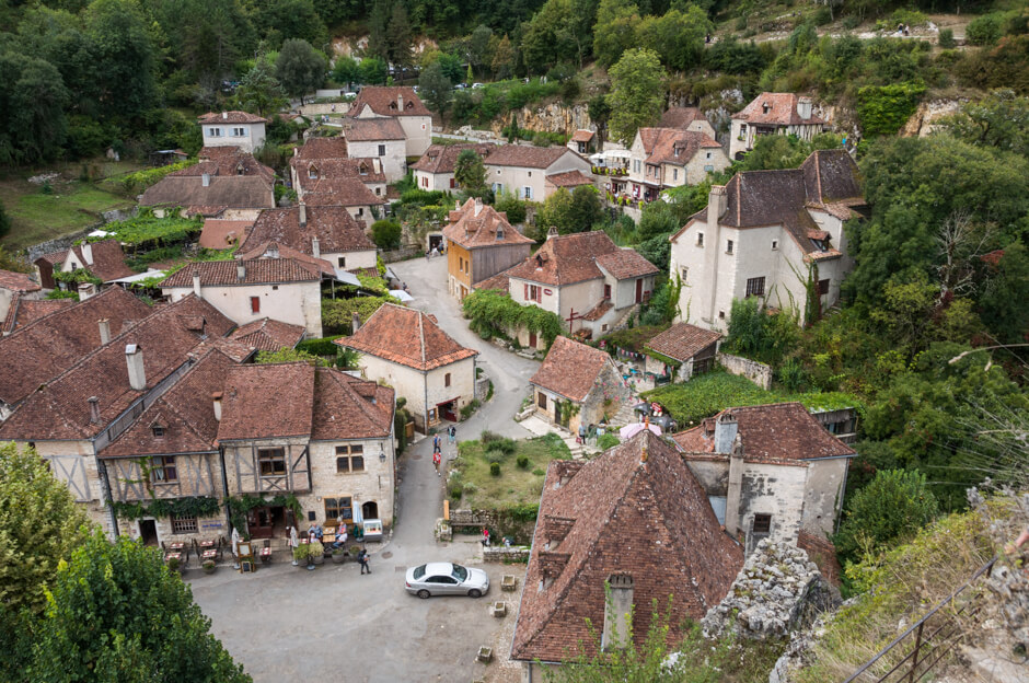
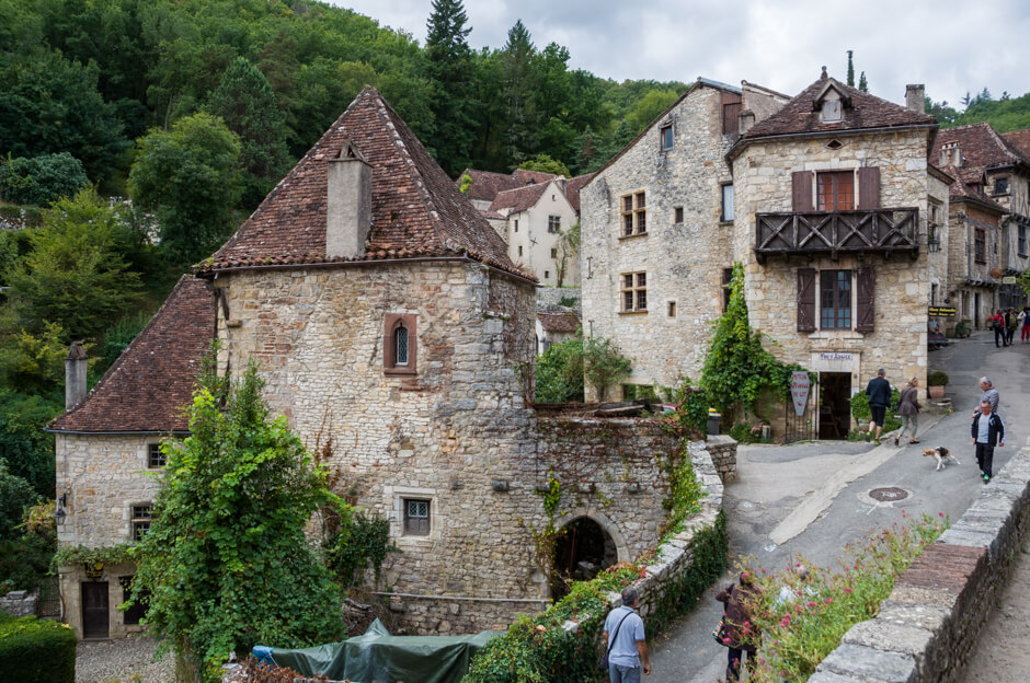
The walk starts along the banks of the Lot over the Chemin de Halage. In the flank of the rock, Daniel Mounier carved the area, like the river with its fauna and flora and the fossils. When you leave the path it goes towards Saint-Cirq-Lapopie. This village towers 80 meters above the river and is labeled "Les Plus Beaux Villages de France". The 13 classified monuments invite you to stroll through the small streets before you start the climb to the viewpoint of the "Rocher de la Popie". On the rock you have a beautiful view of the valley of the Lot and the village. When you leave the village it goes via a nice path with bushes on both sides back to Bouziès.

Download PDF for route description.
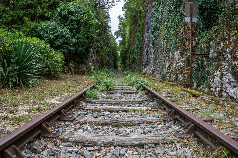
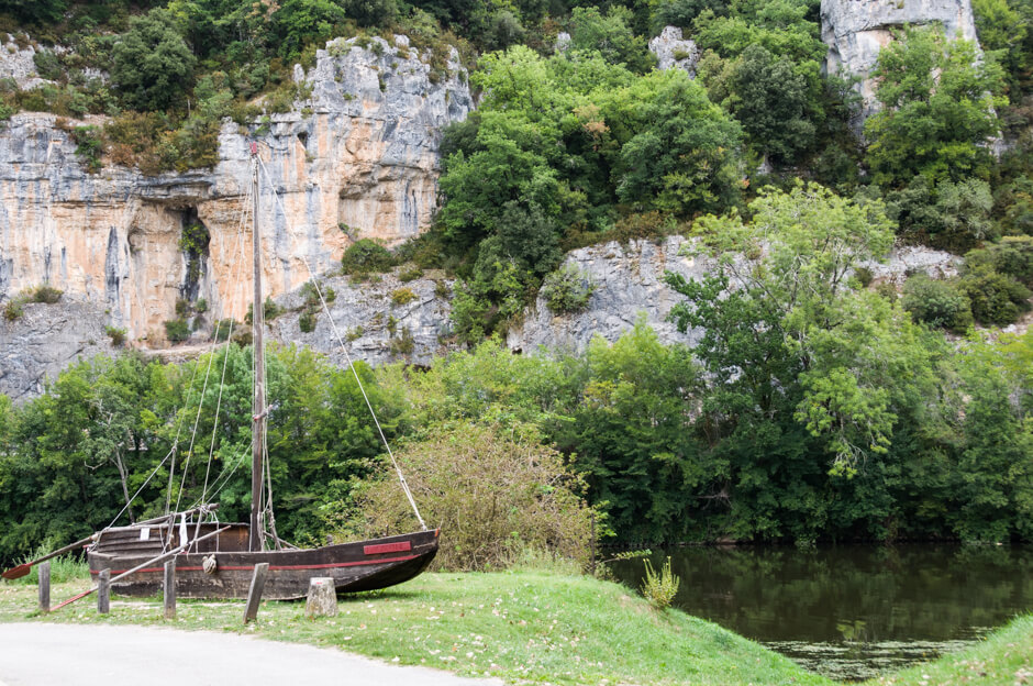
POI 1 - Chemin de Halage.
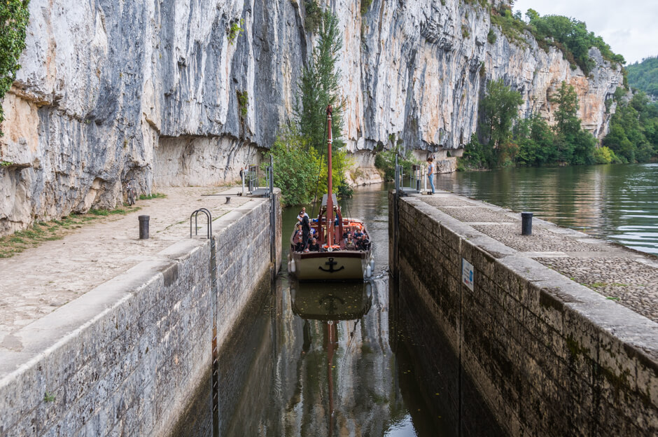
The path of 300 meters long was carved in 1845 and was used to pull flat-bottomed ships in the direction of the Garonne river and further to Bordeaux. The loaded products were wines from Cahors, dried plums and also wooden wine barrels. In 1926 the Lot was closed as a navigable river and has only been navigable back since 1990. This is also the period that Daniel Monnier started sculpting his artwork in the flank of the rock. The Ganil lock is still operated by hand.
Office de Tourisme Cahors.
www.cahorsvalleedulot.com
POI 2 - Saint-Cirq-Lapopie.
The valley of the Lot is probably one of the oldest inhabited areas of Europe. The caves of Pech Merle are almost literally around the corner. It is not known how long this place is already inhabited, but it is plausible that this place was already inhabited in prehistoric times. Cirq-Lapopie is located in a very strategic location and with a few well placed walls and towers it was good to defend against all kinds of villains and invading kings. This was also experienced by the English king Richard Lionheart, yet a nice warlord, who tried to conquer the town in 1199. A few centuries later, the village was in the line of fire during the Hundred Years War between England and France. It regularly changed hands and the La Porte des Anglais still points to this time. Also during the religious wars that plague France in the sixteenth century Saint Cirq-Lapopie is a front town. Until the nineteenth century, the village developed as a regional center for woodturning. Thanks to the large wine areas downstream there was a great demand for wooden barrels, presses, taps and all kinds of other wooden tools. Now there is still one wood turner active in the village. In the first half of the twentieth century the village fell into decline but that changed when after the Second World War a number of artists settled in Saint Cirq.
Office de Tourisme de Saint-Cirq-Lapopie.
www.saint-cirqlapopie.com