The walk departs from the medieval village of Sainte-Jalle through the bois d'Embrun to the Col d'Onglon where you have a beautiful view of Mont Ventoux, among others. After a steep descent you follow a part of the GRP Tour des Baronnies back to the starting point.
Distance: 8 km.
Time: 3h00.
Grade: Easy.
Type: Circular.
Gps Track: Yes.
Route description: Yes.
Wheelchair: Not suitable.
Dog: Allowed.
Height gain: 352 meters.
Trail: Paved and unpaved.
Marking: Yellow dash.
Hiking shoes recommended.
Advertisement.
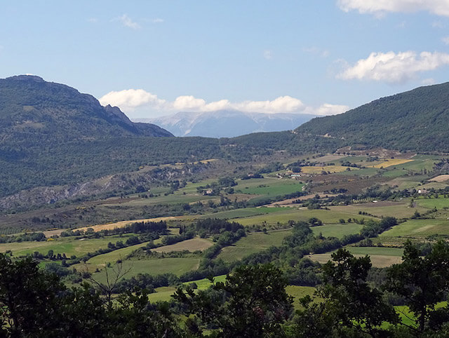
View of Mont Ventoux.
The walk starts from the medieval village of Sainte-Jalle. First you walk on a narrow path through the bois d'Embrun to the top of the Col d'Onglon. When you are almost on the Col you make a slight deviation from the marked path to go to the top. The marked walk goes around the top but you miss the beautiful views. This is followed by a fairly steep descent to Le Moulin. From this point you follow an asphalted road back to the village.

Download PDF for route description.